LiDAR Mapping in El Salvador
Mar 2025 - Present
El Salvador
A groundbreaking partnership with El Salvador's Ministry of Culture to conduct comprehensive LiDAR surveys of the country's archaeological sites. This initiative aims to map and preserve El Salvador's rich cultural heritage.
Project Overview
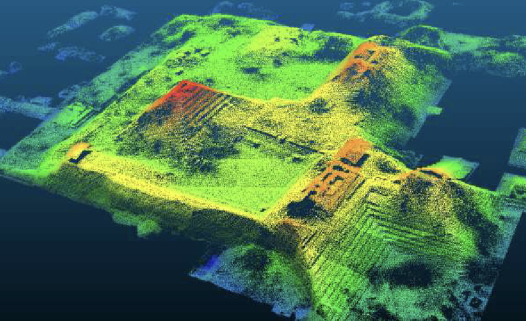
The LiDAR mapping initiative represents a significant advancement in archaeological research in El Salvador. By utilizing advanced laser scanning technology, we're able to create detailed 3D maps of archaeological sites, revealing previously unknown structures and features hidden beneath dense vegetation.
Key Components
- High-resolution LiDAR scanning of archaeological sites
- Data processing and analysis
- Collaboration with local archaeologists
- Preservation of cultural heritage
Impact
This initiative has already led to the discovery of numerous previously unknown archaeological features, providing new insights into El Salvador's ancient civilizations. The data collected will serve as a foundation for future research and preservation efforts.
Get Involved
Researchers and institutions interested in accessing the LiDAR data or collaborating on the project can contact us for more information.